Capella Space Created a Satellite Design to Improve Live Imaging
Daniel Johnson — February 3, 2020 — Tech
References: capellaspace & techcrunch
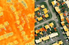
Capella Space created a new satellite design, which was intended to improve live, high resolution, earth images from satellites. The new design allows satellites to provide images of the earth down to 0.5 meters. The company states that the new design is the result of feedback from customers.
The new design by Capella Space means that the company can provide its clients with real-time high-resolution images from space. Some of the company's major clients include the United States government, the United States Air Force, and the National Reconnaissance Office.
The new satellite design uses a ‘synthetic aperture radar’ for images. This means that images can be provided in a 2D format.
Image Credit: Capella Space
Trend Themes
1. High-resolution Satellite Imaging - Opportunity for businesses to leverage high-resolution satellite imaging to improve real-time monitoring and analysis
2. Live Imaging Technology - Disruptive innovation opportunity for industries to utilize live imaging technology to gain a competitive edge in various sectors
3. Synthetic Aperture Radar - Emerging trend in satellite design that enables the provision of high-quality 2D images for a wide range of applications
Industry Implications
1. Government and Defense - Government and defense sectors can harness high-resolution satellite imaging for enhanced intelligence gathering and surveillance
2. Agriculture - Agricultural industry can benefit from live imaging technology to optimize crop monitoring and yield estimation
3. Environmental Monitoring - Industries focused on environmental conservation can utilize high-resolution satellite imaging to monitor and protect natural resources
1.1
Score
Popularity
Activity
Freshness

