Natural Altas Combines a Naturalist Field Guide with GPS Mapping Software
References: naturalatlas
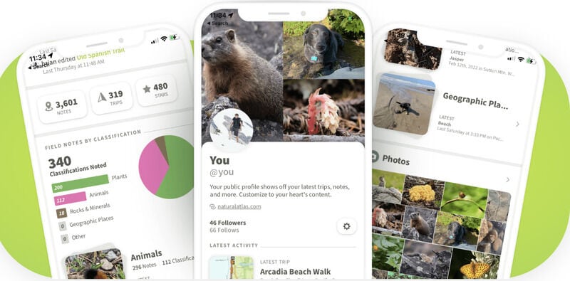
Natural Atlas is a mobile application serving nature enthusiasts and avid adventurers. Marketed as "an exhaustive naturalist field guide" that is strengthened with the implementation of GPS mapping software, Natural Atlas provides exceptional landscape detail, including things like geology, public and private lands delineation, notable points of interest, points of public access, tide and river level information, light conditions, tree cover, and over 1.3 Million Animals and 400,000 Plants.
Natual Atlas adapts to one's location and tailors the content accordingly. The maps are crafted in-house and "designed to awaken a spirit of discovery." Additionally, individuals are able to keep a record of their trips, including path, elevation, and distance, as well as gather field notes of the natural wonders that they cross paths with during the trip. While Natural Atlas is primarily designed for hikers, the app can support other activities such as snowshoeing, portaging, skiing, biking, and more.
Image Credit: Natural Atlas
Trend Themes
1. Nature Exploration Apps - Natural Atlas combines a naturalist field guide with GPS mapping software for nature enthusiasts and adventurers.
Industry Implications
1. Mobile Application Development - There is an opportunity for mobile app developers to create innovative nature exploration apps like Natural Atlas.
2.4
Score
Popularity
Activity
Freshness


