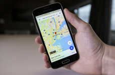
The Google Maps Live Protest Map Directs Demonstrators in London
Amelia Roblin — December 11, 2010 — Social Good
References: maps.google & boingboing.net
The search engine cartogram is acting as an informant for student protesters in London, England -- see for yourself by checking out the Google Maps Live Protest Map. Demonstrators are encouraged to help provide detailed information about police movements throughout the downtown area to protect fellow activists.
With at least one update each hour, the Google Maps Live Protest Map indicates where cops, vehicles and weapons are being deployed and the locations of subway closures and bonfires. Just think of the implications of this information communication in a larger disaster setting.
With at least one update each hour, the Google Maps Live Protest Map indicates where cops, vehicles and weapons are being deployed and the locations of subway closures and bonfires. Just think of the implications of this information communication in a larger disaster setting.
Trend Themes
1. Real-time Protest Mapping - Utilizing real-time maps to track and inform protesters about police movements and other important information during demonstrations.
2. Crowdsourced Activist Mapping - Encouraging activists to collaborate and provide detailed information about events, police deployments, and other relevant data for the benefit of fellow protesters.
3. Disaster Communication Technology - Exploring the potential application of real-time mapping and information sharing technology in disaster situations to facilitate communication and response efforts.
Industry Implications
1. Digital Mapping - Opportunities for companies specializing in digital mapping services to develop platforms that can track and provide real-time information during protests and other events.
2. Social Activism - Expanding possibilities for organizations and platforms focusing on social activism to leverage technology and crowdsourcing to enhance protest coordination and safety measures.
3. Emergency Management - Potential for incorporating real-time mapping and communication technologies in emergency management systems to improve situational awareness and response in disaster scenarios.
1.1
Score
Popularity
Activity
Freshness


