Atlas.co Allows Users to Build, Share, and Edit Maps Collaboratively
Ellen Smith — October 8, 2024 — Lifestyle
References: atlas.co
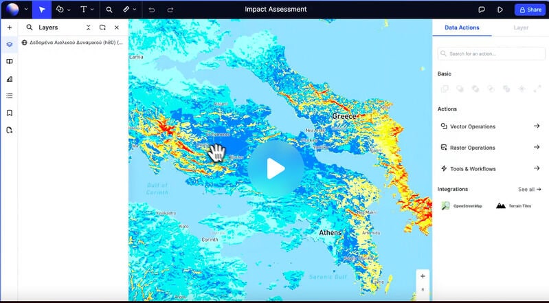
Atlas.co is a browser-based collaborative Geographic Information System (GIS) and mapping platform designed for teams to create and manage maps in real-time. This innovative tool streamlines the mapping process, allowing users to build, share, and edit maps collaboratively without the need for specialized software.
Atlas.co enables users to visualize complex data sets seamlessly, offering interactive features that help in exploring geographic insights more effectively. This platform is particularly beneficial for businesses and organizations that rely on spatial analysis for decision-making, as it enhances collaboration among team members and stakeholders. By providing a user-friendly interface, Atlas.co democratizes access to GIS capabilities, making it easier for professionals across various sectors to harness the power of location-based data for strategic planning and operational efficiency.
Image Credit: Atlas.co
Trend Themes
1. Real-time Collaborative Mapping - The ability for teams to create, share, and edit maps in real-time significantly enhances project cohesion and decision-making speed.
2. Democratized GIS Access - By offering an intuitive interface usable without specialized software, map management platforms make geographic information systems accessible to a broader range of professionals.
3. Interactive Data Visualization - Integrating interactive features in mapping platforms allows for more effective exploration and communication of complex geographic data.
Industry Implications
1. Urban Planning - Urban planners can utilize collaborative GIS platforms to streamline stakeholder engagement and enhance spatial analysis for better city development.
2. Logistics and Supply Chain - Logistics firms gain from real-time map collaboration by optimizing routes and improving supply chain efficiency.
3. Environmental Management - Environmental managers benefit from the ability to collaboratively map and analyze data, which leads to more informed conservation and resource management strategies.
4.6
Score
Popularity
Activity
Freshness


