Space Satellite Produces World's First-Ever Gravity Field Map
Katie Cordrey — July 18, 2010 — Eco
References: geophysics.ou.edu & gajitz
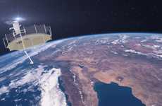
The gravity field map known as GEOID was generated from readings taken by a low-orbiting known as GOCE, which stands for Gravity field and steady-state Ocean Circulation Explorer. GOEC precisely measures the Earth's gravitational field and the data is used to create the gravity field map.
The GEOID gravity field map will help in studying oceans, predicting volcanoes and earthquakes, helping with structural engineering, and providing a better understanding of Earth's gravity.
Implications - Consumers in modern society are interested in learning more about the world they live in. Coming out with more products that allow for greater exploration of the planet could help a company increase its appeal on the market.
Trend Themes
1. Gravity Field Mapping - Technology that allows for precise measurement of Earth's gravitational field presents opportunities for advancements in various industries such as geology, engineering, and space exploration.
2. Oceans and Volcanoes Analysis - The availability of the GEOID gravity field map aids in the study and prediction of ocean behavior, volcanic activity, and geological phenomena, creating opportunities for scientific research, disaster prevention, and resource management.
3. Structural Engineering Optimization - Utilizing the data from the GEOID gravity field map can lead to improved structural engineering designs, ensuring the safety and efficiency of buildings, bridges, and other infrastructure projects.
Industry Implications
1. Geology - The gravity field map can revolutionize geological studies, leading to better understanding of Earth's surface and subsurface features, and enabling new discoveries in natural resource exploration and environmental analysis.
2. Engineering - The precise measurement of the gravitational field opens up possibilities for innovative engineering approaches, optimization of structures, and development of advanced materials to withstand various environmental conditions.
3. Space Exploration - The gravity field map provides valuable insights for space agencies and private enterprises engaged in space exploration, supporting mission planning, navigation, and the study of other planets and celestial bodies.
2.7
Score
Popularity
Activity
Freshness


