'Google Maps Streetview Player' Collates Images for a Complete Trip
References: brianfolts & fieldguide.gizmodo
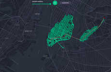
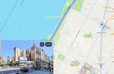
Google Street View is a helpful tool for letting users get a sense of the landmarks in a new area where they're traveling, but the Google Maps Streetview Player application is an even more efficient way for users with a limited sense of direction to stay oriented. The site automatically collates every single Street View image that makes up the given trip, letting people preview exactly what their upcoming trips will look like.
Google Maps Streetview Player is a third-party application built by programmer Brian Folts, but it nonetheless comes with many of the key features of the Google Maps system. For instance, users can select different modes of transportation aside from driving, such as cycling, public transit, or walking.
Google Maps Streetview Player is a third-party application built by programmer Brian Folts, but it nonetheless comes with many of the key features of the Google Maps system. For instance, users can select different modes of transportation aside from driving, such as cycling, public transit, or walking.
Trend Themes
1. Online Map Animators - Opportunity for developing applications that collate and animate Street View images for trip previews.
2. Efficient Trip Previews - Opportunity to create tools or services that automatically collect and display Street View images for upcoming trips.
3. Expanded Transportation Selection - Opportunity to enhance transportation selection options in map applications to include cycling, public transit, and walking.
Industry Implications
1. Travel and Tourism - Disruptive innovation opportunity for travel agencies or tour operators to offer detailed trip previews using collated Street View images.
2. Navigation and Mapping - Opportunity for companies in the navigation and mapping industry to develop tools or services that automatically create trip previews using Street View images.
3. Transportation and Logistics - Opportunity for transportation and logistics companies to incorporate expanded transportation selection options, such as cycling, public transit, and walking, into their map applications.
3
Score
Popularity
Activity
Freshness

