Fort Wayne Trails & Aws Foundation Launch Accessible Trail Maps
Kalin Ned — July 25, 2024 — Art & Design
References: journalgazette.net
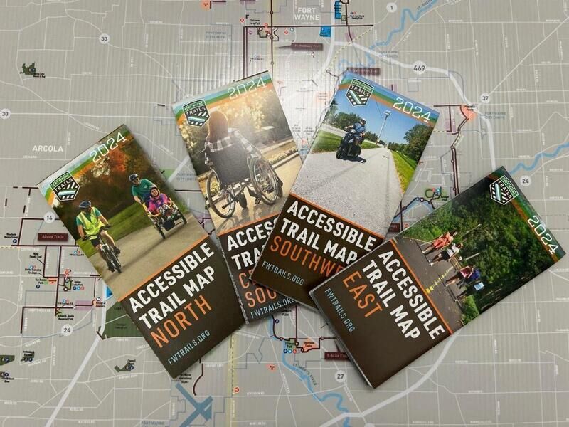
Fort Wayne Trails, in collaboration with AWS Foundation, has announced the launch of new accessible trail maps for Allen County. These maps are designed to improve accessibility for residents and will be available at several locations.
The maps are divided into four quadrants — north, east, southwest, and central/southeast. They rovide detailed information about the trails in each area. They feature larger font sizes and bolder colors to enhance readability for individuals with vision impairments. Additionally, a sticker sheet is included for users to mark important locations such as restrooms, schools, and mile markers.
Consumers may find these new accessible trail maps particularly beneficial as they offer a more inclusive way to navigate the county's 140 miles of trails. For individuals with disabilities, the enhanced readability and customization options provide greater independence and confidence in exploring outdoor spaces.
Image Credit: Fort Wayne Trails
Trend Themes
1. Inclusive Navigation Solutions - Enhanced trail maps with readability features cater to individuals with vision impairments.
2. Customized Outdoor Exploration - Sticker sheets allow users to personalize their navigation experience, marking essential locations like restrooms and schools.
3. Quadrant-based Mapping - Dividing the trail maps into quadrants offers improved organization and ease of use for exploring large outdoor areas.
Industry Implications
1. Geospatial Technology - Innovations in map readability and customization provide inclusive navigation tools for individuals with disabilities.
2. Outdoor Recreation - Accessible trail maps enhance the outdoor experience for residents, encouraging broader participation in recreational activities.
3. Assistive Technology - Developing tools like enhanced maps focuses on creating more independent and confident exploration for people with visual impairments.
2.4
Score
Popularity
Activity
Freshness


